

Commanding the Sky – High-Precision Spatial Mapping & Sweeping Panoramic Visuals for Mega Infrastructures
Capturing the true grandeur of massive multi-acre properties, heavy civil construction projects, regional highway stretches, or high-volume public political rallies is impossible from the ground. Traditional cameras fail to display spatial connectivity and absolute structural magnitude. The modern corporate layout requires an authoritative, stabilizing perspective from the sky to captivate boardrooms, tender evaluation committees, and global stakeholders.
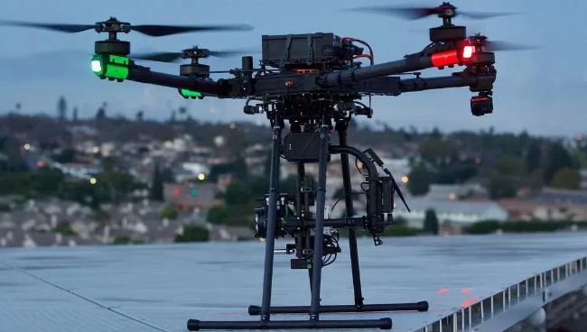
Our dedicated Aviation & Aerial Media Division specializes in delivering military-grade stabilized bird’s-eye visuals and technical layout parameters. Utilizing advanced drone tech setups since 2018, we operate as the absolute premier sky-scouting force in Maharashtra.
Technical Applications & Capabilities
Infrastructure Progress Tracking
We shoot Scheduled monthly or quarterly 4K/8K aerial sweeps of national highways, bridge girders, canal layouts, and railway grids, keeping data logs perfectly consistent for project compliance.
Real Estate Master-Plan Previews
Capturing breathtaking panoramic footage of sprawling mega townships, commercial towers, and open plotting schemes during the magical golden hour to display luxury connectivity to premium buyers.
Post-Production Visual Motion Tracking
We don't just supply raw sky clips. In our editing suites, we overlay advanced 2D/3D call-out tracking motion graphics directly onto the drone footage to digitally mark structural check-points, plot borders, and distance indexes (e.g., Upcoming Metro Station 500m).
Certified On-Set Aviation Safety
Our operators are highly trained and certified drone pilots who follow rigorous safety check-lists. They navigate complex high-voltage corridors, industrial dust belts, and tight urban spaces flawlessly without ever breaking on-site workflow speed.